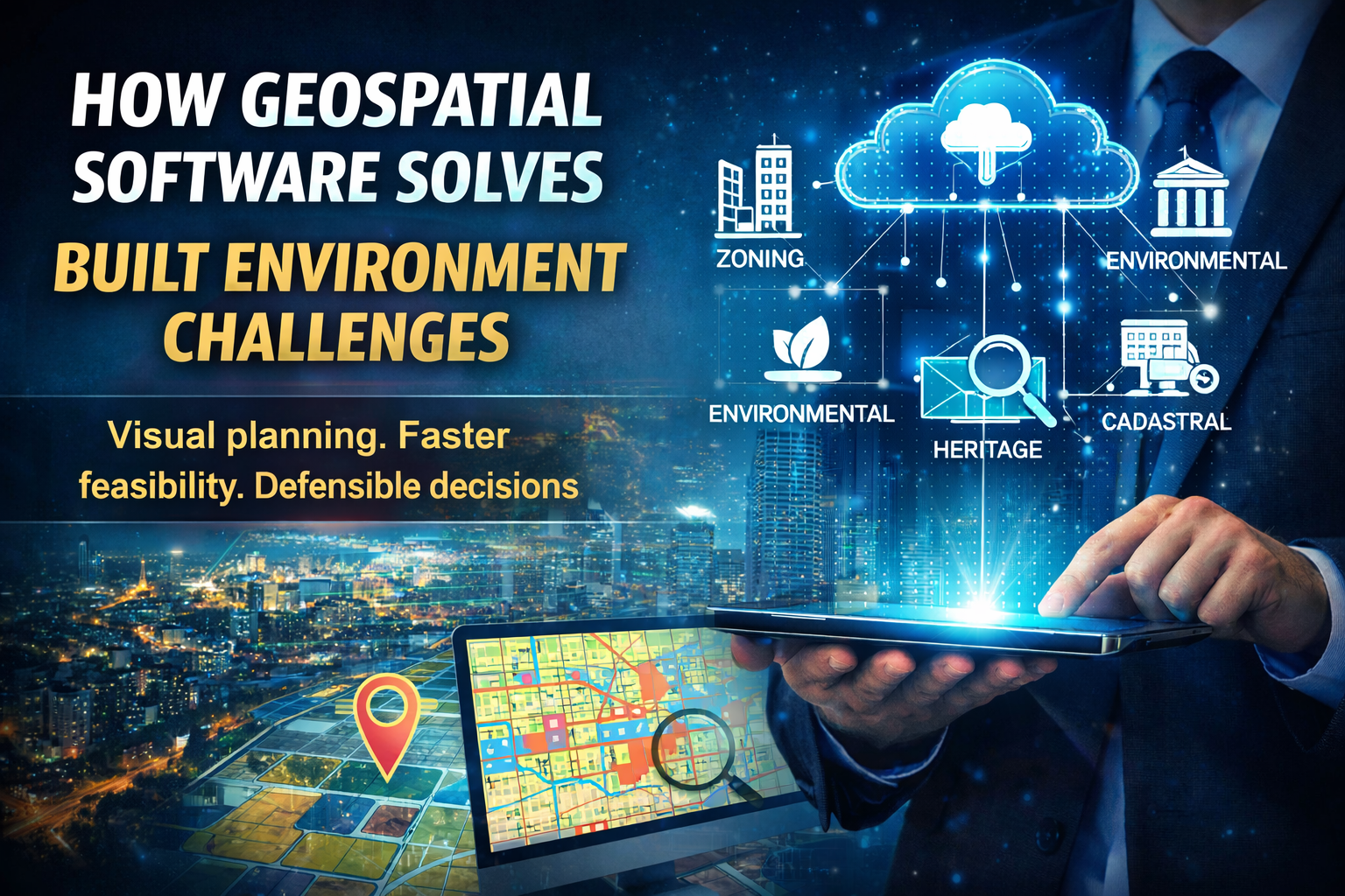
How geospatial software solves built environment challenges
From zoning uncertainty to EIA screening—turn spatial complexity into faster, defensible decisions.
From zoning uncertainty to EIA screening—turn spatial complexity into faster, defensible decisions.
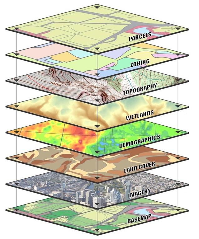

Key ingredients: clear objectives, representative attractors/constraints, and transparent weightings.

Buffers, street connectivity, access to destinations, and minimum density thresholds.